Portfolio: UAV-based Diagnostics of Structures
- Introduction
- UAV and Cameras
- Services
- Videos
- Literature
- Reference #1: Leaning Tower Bad Frankenhausen
- Reference #2: Retaining wall
- Reference #3: Anna Ebert Bridge
- Reference #4: Indoor flight and 3D model of a sculpture
Introduction
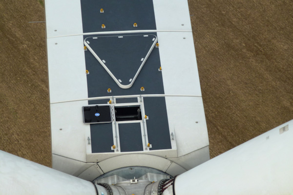
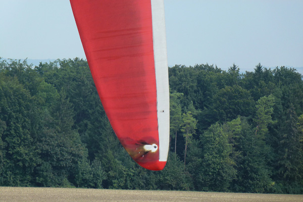
Inspection, diagnostics and continuous condition monitoring are key elements in the maintenance of structures. We have specilised in the application of UAV (Unmanned Aerial Vehicle, also: drone) technology for remote visual sensing of structures. Using cutting edge professional UAVs we provide a range of services based on expertise from various research projects and experience gained from inspections of a wide range of structures such as bridges, dams, wind turbines and historical buildings.
Our UAV systems are equipped with high-performance cameras for capturing still images as well as providing HD live video streams for inspection purposes. This allows for a rapid, safe and cost-effective acquisition of high quality visual data that can be used for a large range and post processing purposes.
Our drone-related services can now be found at infralytica.com
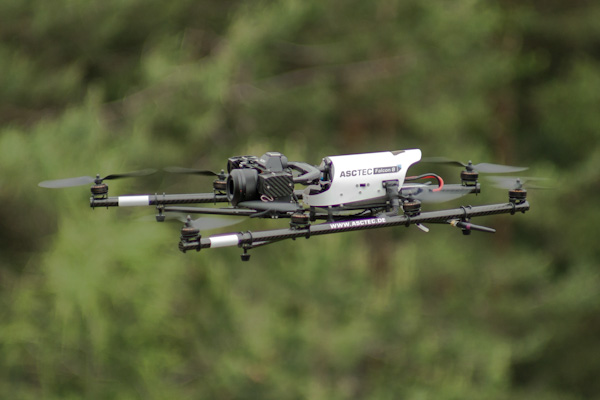
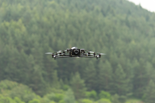
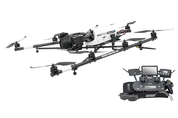
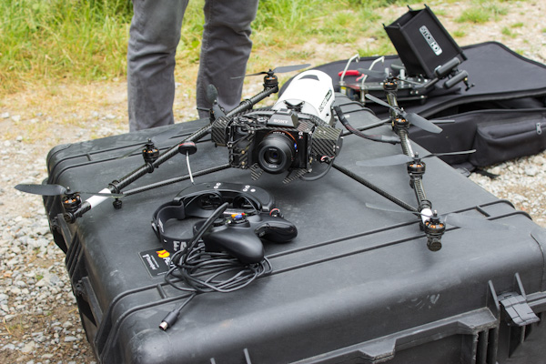
UAV and Cameras
We use high-end last-generation professional flight systems Falcon 8 by Ascending Technologies. Some important features of these Unmanned Aerial Vehicles are:
- Extremely stable platform even in strong gusty winds
- Autopilot Asctec Trinity
- Payload capable of mounting professional grade SLR camera equipment
- 360° camera field of view
- GPS and altitude controlled flight modes for outdoor and indoor missions
- Advanced navigation planning for semi-autonomous flight and data acquisition of large-scale structures and terrains
The camera technology includes both still and HD video equipment:
- Sony Alpha 7R (3mm full format sensor system camera with misc. lenses, 36 MP)
- Sony Nex5 (system camera with misc. lenses, 16.1 MP)
- Sony Camcorder HDR-PJ810E (video camera, 24 MP, Full-HD, 12x optical zoom)
Services
In numerous research and consulting projects we have been able to perform extensive inspections on structures using UAV and have continuously widened the scope of possible applications of UAV in structural diagnostics. Today we can offer a range of services that allow for a tailor-made documentation of structural state and change detection. Some of the possible applications and data processing methods are listed below.
Recent projects, examples of image data analysis and services offered by the company can also be found in our UAV brochure (download).
Documentation of structural state and identification of damage
- Outdoor and indoor flights and still photo acquisition
- Creation of overview photos, orthophotos, stitching of images to large scale complete-cover images
- Photo and video based damage identification, documentation and analysis
UAV-based Photogrametry
- Outdoor and indoor photogrametry
- Photogrametric image acquisition for creating orthophotos for scaled measurable site plans (project planning etc.), elevations (facades etc.)
- High-resolution ([mm] accuracy) geo referenced 3D point clouds
- High-resolution ([mm] accuracy) meshed geo referenced 3D models of buildings and structural members
- Geo referenced terrain models
Applications in Conservation of Heritage Structures
- Contactless diagnostics and damage identification of fragile structures
- Highly detailed image and video analysis of special structural members, sculptures and artifacts
- Data documentation for planning of rehabilitation and restoration works
- Continued diagnostics through regular data acquisition (e.g. monitoring of deformations and cracks)
- High-resolution ([mm] accuracy) geo referenced 3D point clouds and meshed 3D models of terrain (e.g. archaeological excavation sites) and historical sites (castles etc.)
- To-scale 3D models of structural members and sculptures
Construction site survey and surveyance
- Documentation of construction progress
- Site management, logistics and safety
- 3D point clouds and 3D models for assessment of geometric tolerances
Data Acquisition for Urban and Regional Planning, Project, Property and Real Estate Development and Marketing
- Aerial imagery (Overview, skew angle, plan and elevation)
- Video capturing (dynamic flight)
- Panoramas
- 360° spherical panoramas
- Virtual tours
- 3D terrain and bulding models
Videos
The following videos have been produced as part of projects carried out together with Ascending Technologies (AscTec). They provide a good overview of modern structural inspection using UAV and possibilities of data processing and presentation.
Anna-Ebert-Bridge Magdeburg:
Leaning Tower Bad Frankenhausen:
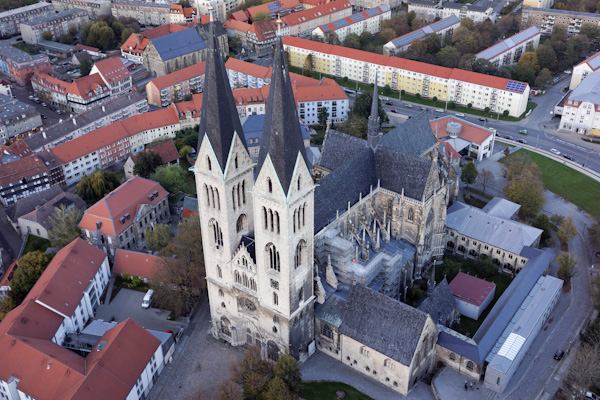
Cathedral of Halberstadt:
Bridges and wind turbines:
Rock consolidation:
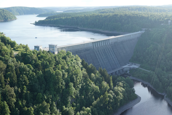
Rappbodetalsperre (dam):
Castles:
Retaining wall:
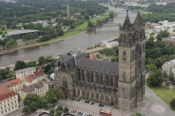
Cathedral of Magdeburg:
Literature
The following documents provide an overview of recent research-focussed work using UAV.
- GMTIB UAV brochure (download)
- Final report Zukunftbau project “Unbemannte Fluggeräte zur Zustandsermittlung von Bauwerken” (download)
- Morgenthal, G., Hallermann, N., Quality Assesment of Unmanned Aerial Vehicle (UAV) Based Visual Inspection of Structures Advances in Strucutural Engineering, Volume 17, 3 (2014), pp. 69-80 (download)
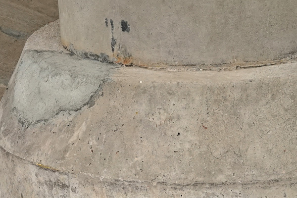
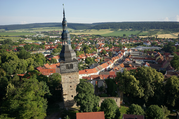
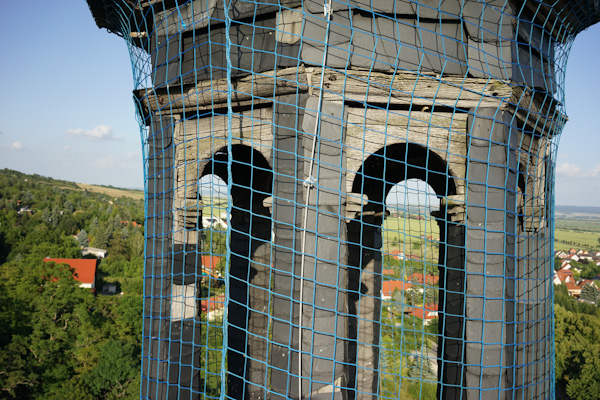
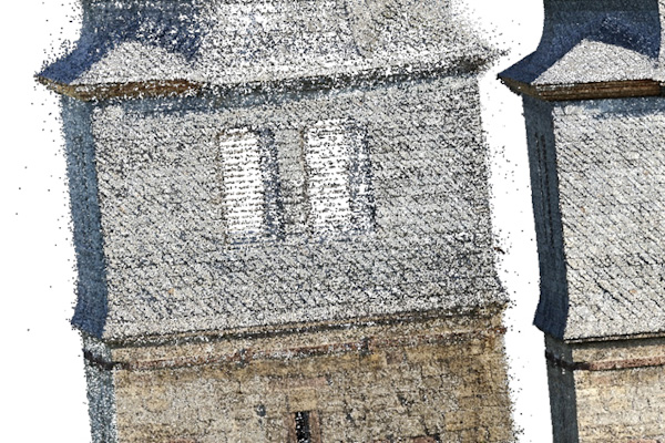
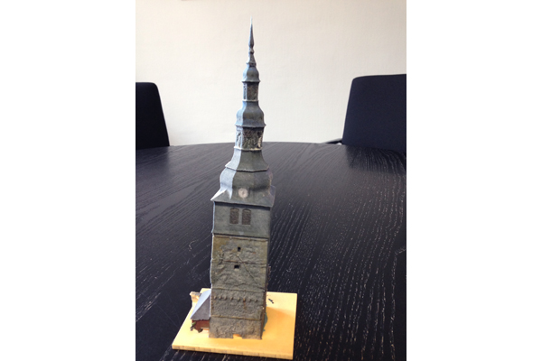
Reference #1: Leaning Tower Bad Frankenhausen
Services
The structure of this tower is of cultural significance and a detailed damage identification as well as 3D geometry reconstruction were performed using UAVs.
The works included:
- Capturing entire structural surface with 525 high-resolution photos
- Detailed state documentation of all critical elements and structural members
- Orthophotos
- Photogrametric 3D reconstruction: creation of a geo referenced 3D point cloud with 310 mio points
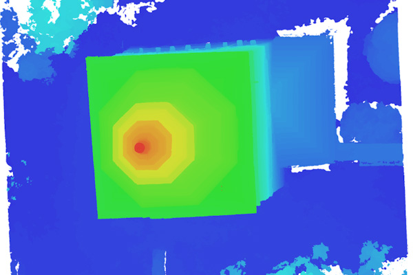
- Elevation model (contour plots)
- Meshed 3D model with 62 mio polygons
- Scale model printed with 3D printer

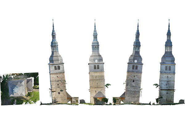
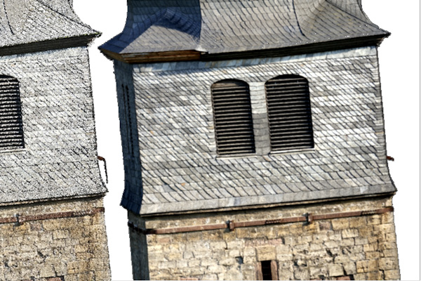
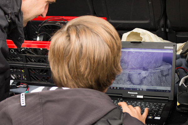
The data acquired using UAV at the Leaning Tower of Bad Frankenhausen has been used to create a high-resolution 3D model of the structure. This was then employed for visualisation purposes as well as for determining geometric properties to a high accuracy. The process of model generation is shown in the video below.
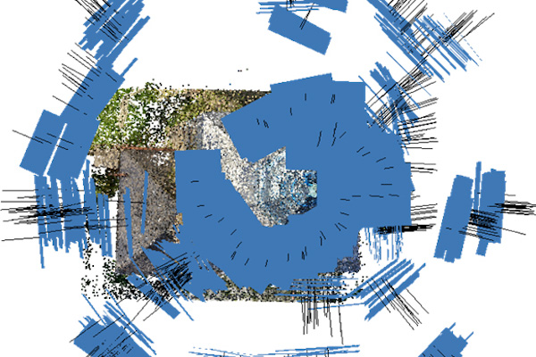
3D Model Viewer
Click the preview image below for an interactive version of the 3D model. Note that the resolution has been reduced drastically (to approx. 1%) to allow web viewing. Please wait for the model to load, view using mouse buttons/wheel to rotate/zoom. Please consider switching to fullscreen mode.
Panorama
The UAV imagery of Bad Frankenhausen generated during investigations of the Leaning Tower have been used to create a 360 degree panorama of the site which can be viewed below (click-drag mouse inside the frame).
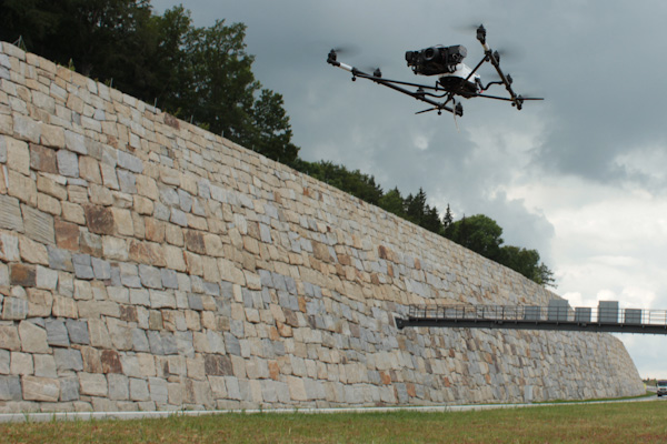
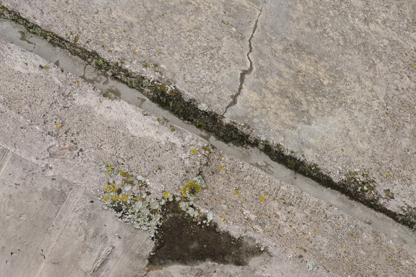
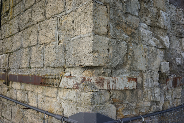
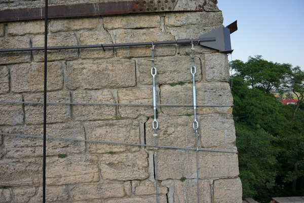
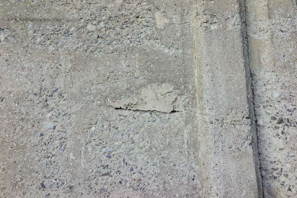
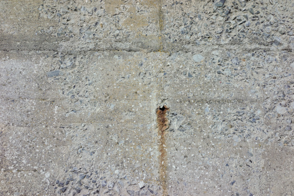
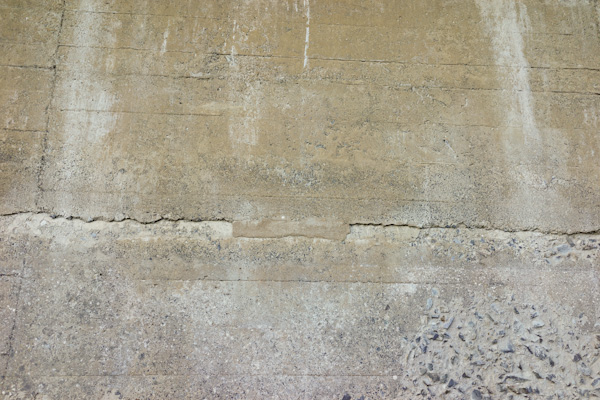
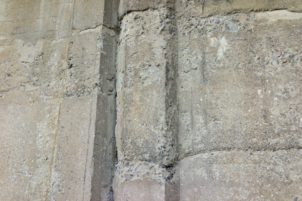
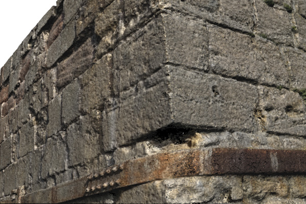
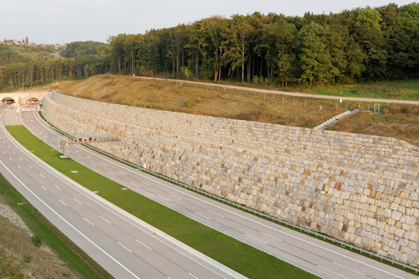
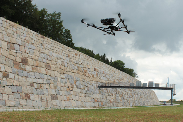
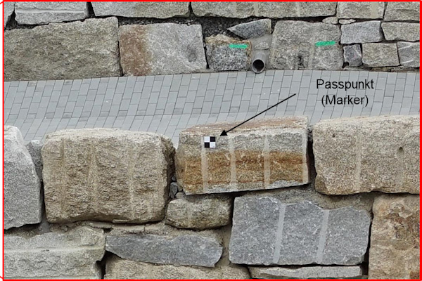
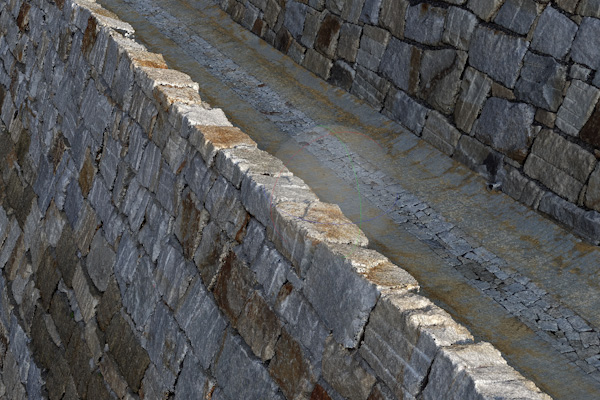
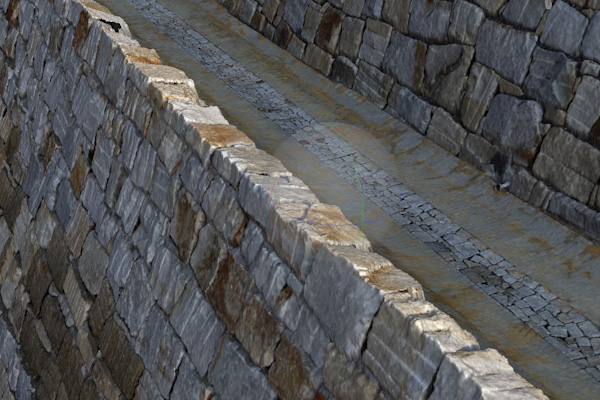
Reference #2: Retaining wall
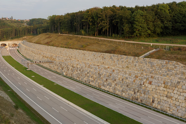
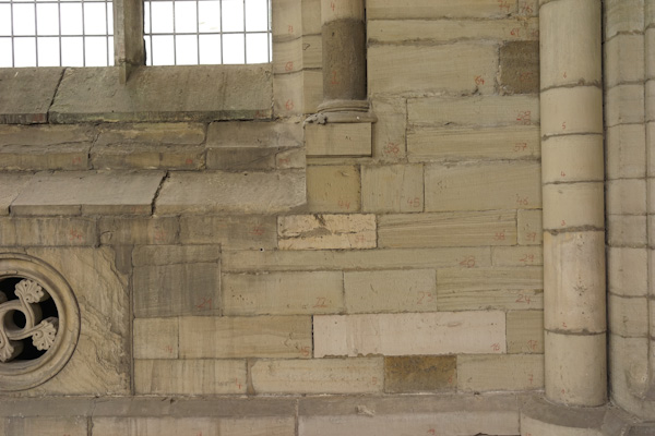
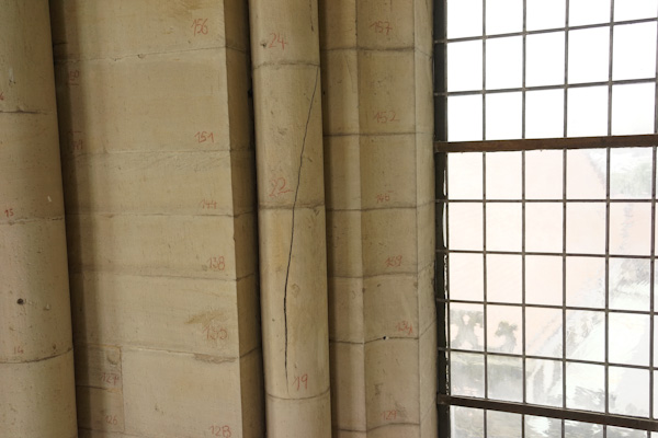
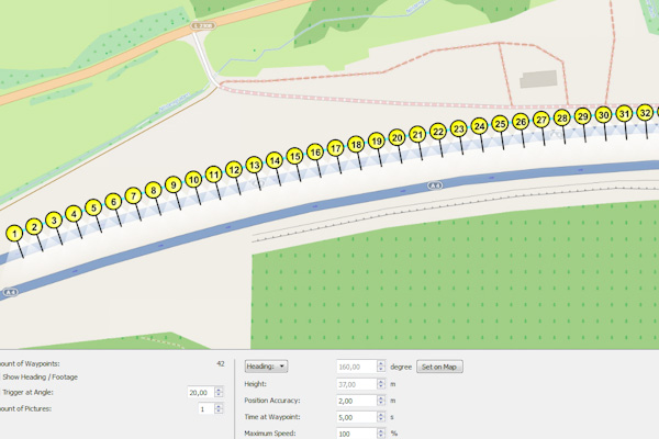
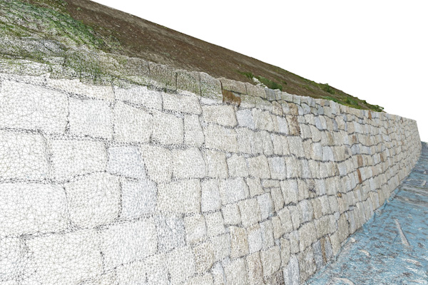
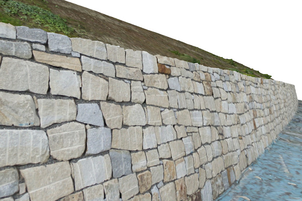
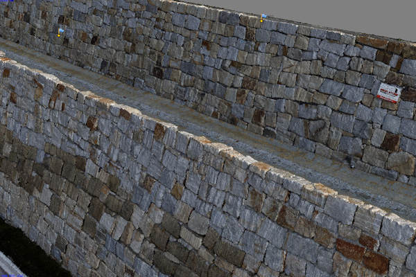
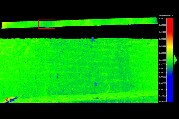
Large retaining walls composed of natural stone blocks are used along roadways as embankment structures. A 650m long section at the motorway A4 near Jena was recorded by UAV semi-autonomously. The flight paths and camera shot positions and directions were pre-programmed and 280 aerial images were taken within 45 minutes on 4 flight routes.
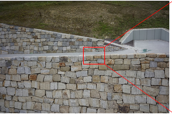
With the images, a 3D model of the 20m high wall was created on the basis of a point cloud of 1.9 billion points. This model is stored and will be used in the future to detect deformations of the wall over time. On the basis of the photogrametric accuracy it has been determined, that deformations of 7mm and above can be reliably detected.
The project was performed in the following steps:
- Mission planning of flight navigation of autonomous capturing of images to cover entire wall
- Data acquisition without traffic interference on neighbouring motorway
- Computation of orthophotos
- Photogrametric 3D reconstruction: creation of a geo referenced 3D point cloud
- Meshed 3D model with <5mm accuracy on each point (supported by reference points surveyed with total station and marked on the structure)
- Data storage for future change detection (wall deformations) based on a repeat flight (trial performed successfully)
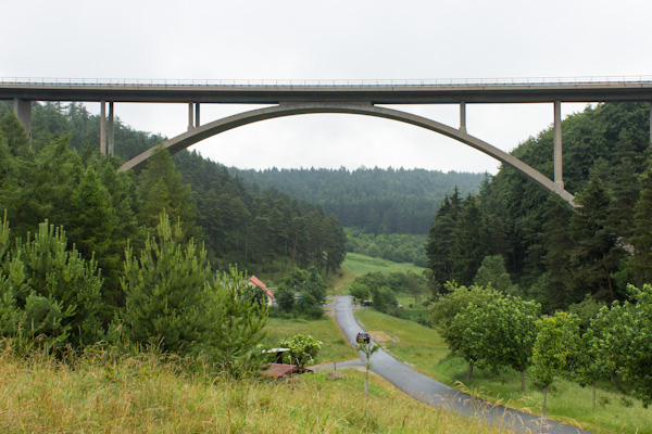
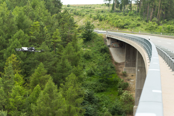
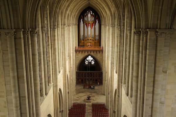
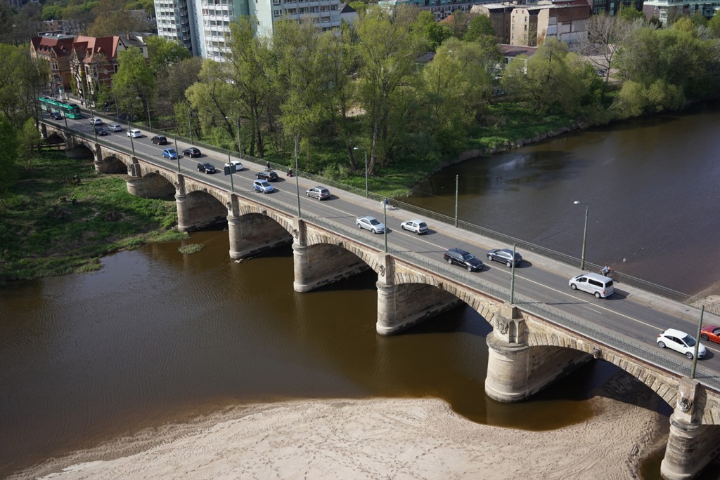
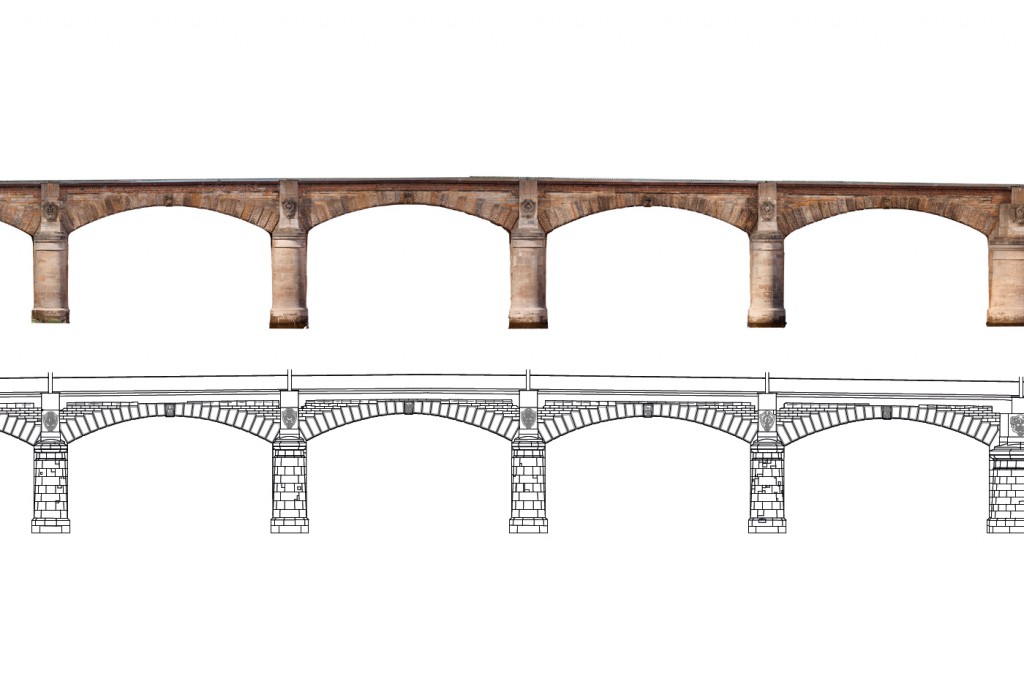
Reference #3: Anna Ebert Bridge
In 2016 a complete documentation of the historical Anna Ebert Bridge in Magdeburg was undertaken based on UAV data and photogrammetric analysis as preparation for significant refurbishment works on the bridge. Our scope included:
- Mission planning of flight navigation
- Complete image data acquisition using UAV
- Generation of a geo referenced high-resolution complete 3D model of the bridge
- Computation of orthophotos of side and top views
- Preparation of stone drawings of the bridge elevations to support refurbishment planning
- Preparation of high-resolution 3D models of all ornaments of the bridge
- Preparation of fly-through documentation videos
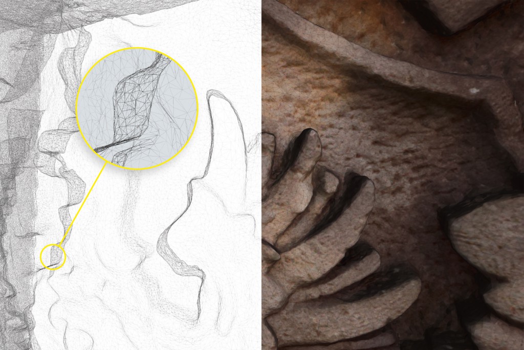
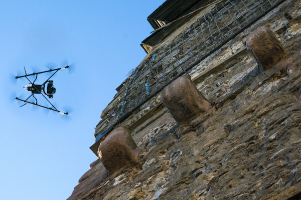
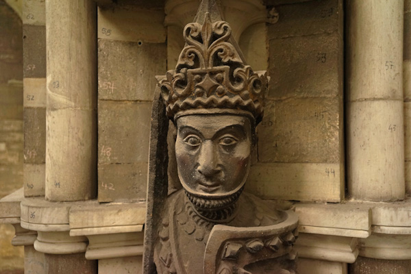
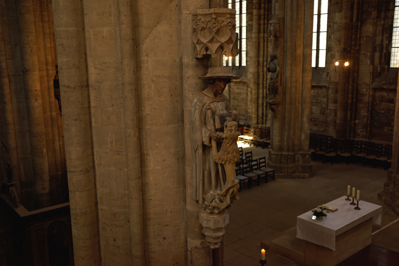
Reference #4: Indoor flight and 3D model of a Sculpture
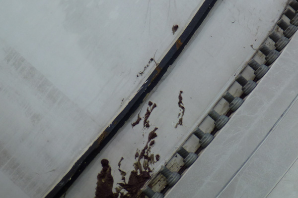
Indoor UAV flights at the Cathedral Halberstadt delivered imagery of several sculptures that were otherwise impossible to inspect in detail. A photo from within the cathedral is shown below.
Although lighting conditions were extremely challenging, a test sculpture could be captured by photos which were then used to create a high-resolution 3D model. Click the preview image below for an interactive version of the 3D model. Note that the resolution has been reduced drastically (to approx. 1%) to allow web viewing. Please wait for the model to load, view using mouse buttons/wheel to rotate/zoom and please consider switching to fullscreen mode.